 Photo credit: NASA
 Photo credit: NASA
The Aurora Borealis and lights over Finland, Russia, Estonia and Latvia. The cluster of stars to the lower right of the thin crescent Moon is the Praesepe or Beehive Cluster in Cancer. Just to the right of that is the planet Saturn.
The Earths Atmosphere.
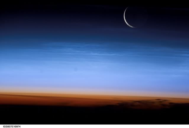 Photo credit: NASA
The limb of the Earth at the bottom transitioning into the orange troposphere. The troposphere ends abruptly at the tropopause, which appears in the image as the sharp boundary between the orange and blue atmosphere. The silvery-blue noctilucent clouds extend far above the Earth's troposphere.
Night View Of Los Angeles, California
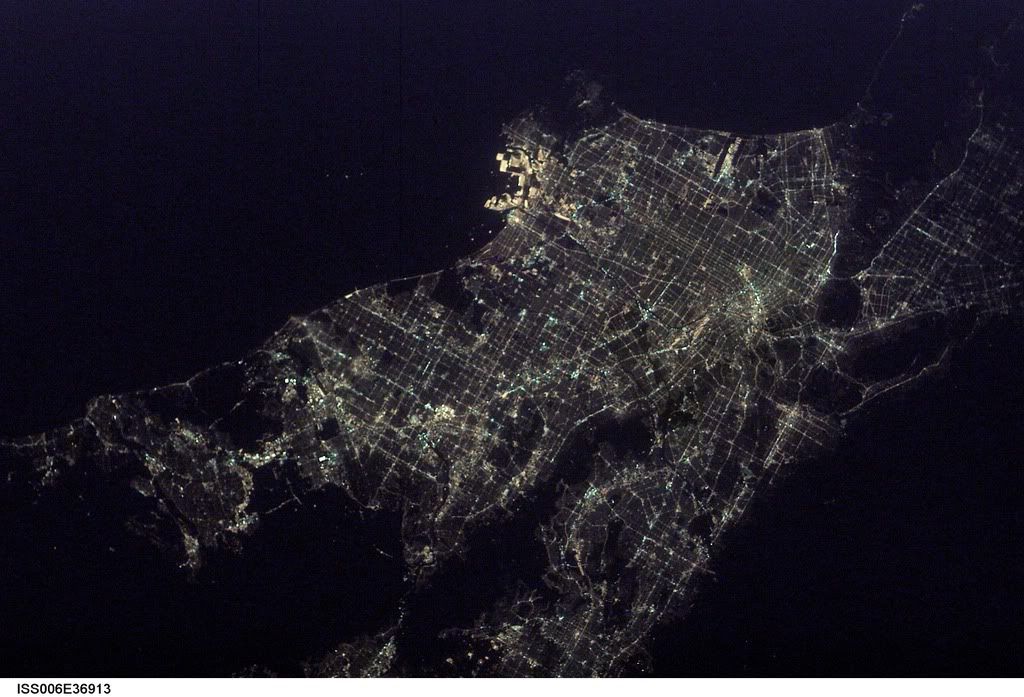 Photo credit: NASA
Hollywood is nestled against the south side of the Santa Monica Mountains. On the coast, Los Angeles International Airport (LAX) and the port facilities at Long Beach Naval Shipyards can be seen as bright spots.
Eruption of The Cleveland Volcano, Aleutian Islands, Alaska
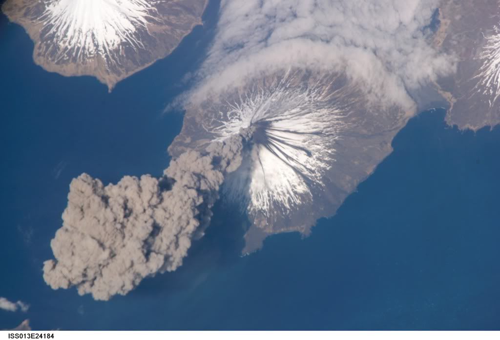 Photo credit: Jeffrey N. Williams & NASA
This image, acquired shortly after the beginning of the eruption, captures the ash plume moving west-southwest from the summit vent. The eruption was short-lived; the plume had completely detached from the volcano summit two hours later.
Harrat Khaybar, Saudi Arabia
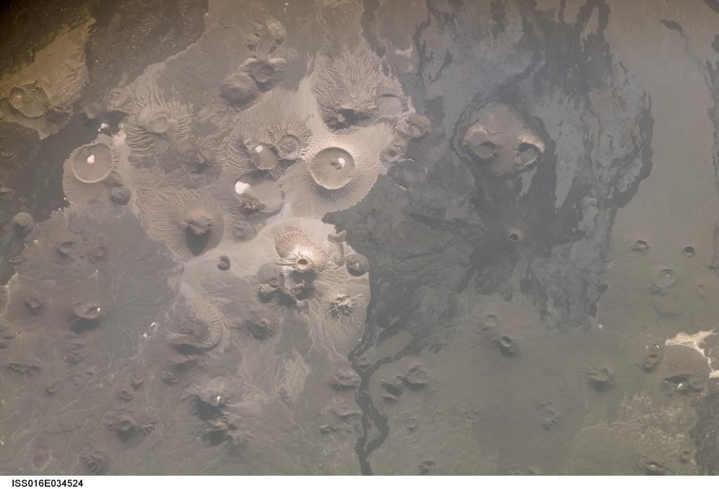 Photo credit: NASA
Extensive lava fields known as haraat cover large areas in Saudi Arabia. One such field is the 14,000-square kilometer Harrat Khaybar, located approximately 137 kilometers to the northeast of the city of Al Madinah.
Nukuoro Atoll, Federated States of Micronesia.
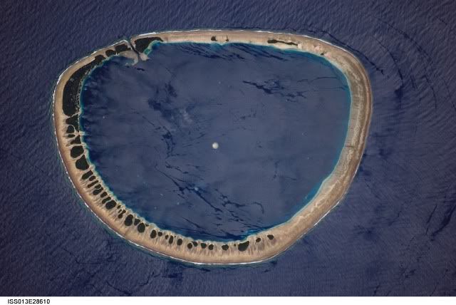 Photo credit: NASA
Nukuoro Atoll is part of the Caroline Island chain, which stretches northeast of Papua New Guinea in the western Pacific. Nukuoro is one of 607 islands that make up the Federated States of Micronesia.
Green Aurora.
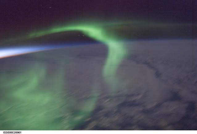 Photo credit: NASA
The reds and blues of a sunset light up the air layer to the west, while a green aurora dances along the earths magnetic field.
Bernese Alps, Switzerland.
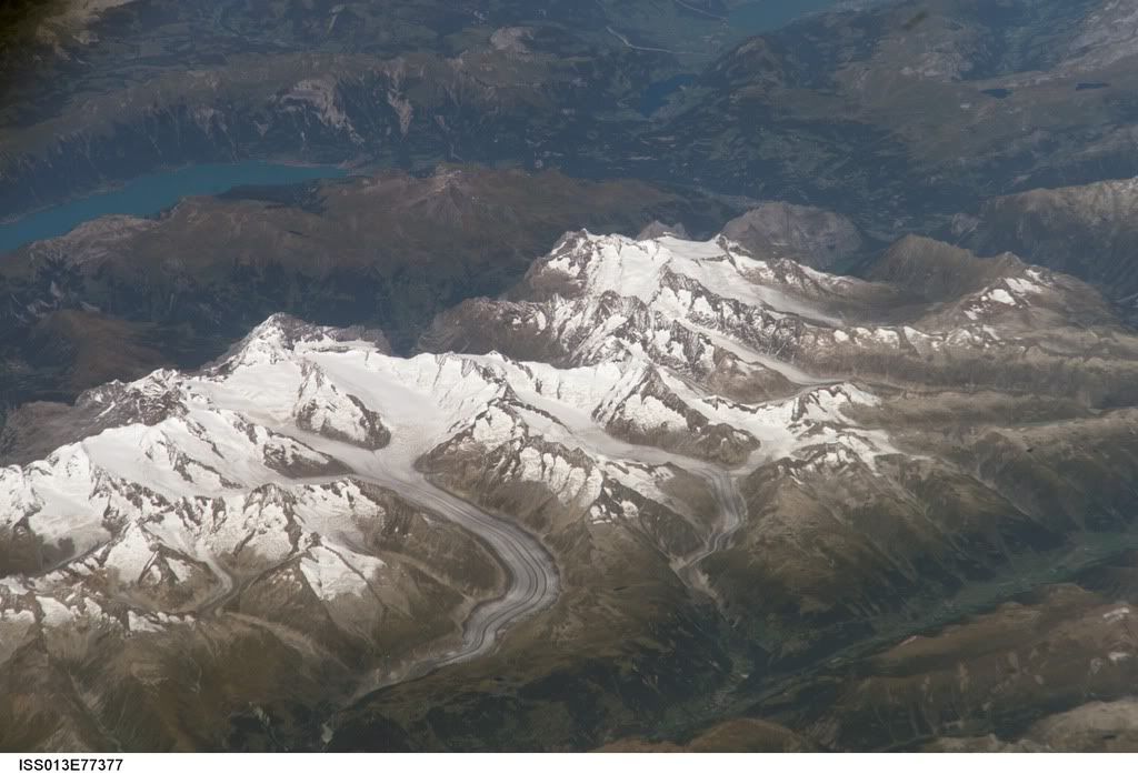 Photo credit: NASA
The Aletsch Glacier dominates the centre of the picture, clearly marked by dark medial moraines extending along the glacier's length parallel to the valley axis.
Mount Everest and Makalu

Photo credit: NASA
The summits of Makalu on the left (8,462 meters: 27,765 feet) and Everest on the right (8,850 meters; 29,035 feet) are at the heights typically flown by commercial aircraft. They can only be seen at this height and angle from the International Space Station.


1 comment:
This is beautiful, but why isn't this technology used to locate Osama bin Laden? Or is it? This will certainly be useful.
Post a Comment